Tag Archives: gps
October 13, 2011

Where in the World Are You?

You really need to click here for a closer look!

Early on, on this round-the-world trip of ours, Oksana and I had a serious conversation about just dumping all our electronics gear — our laptops, our cameras, all the batteries and chargers; everything but our clothes — and continuing on without it.  It would have probably halved the weight of our bags, but more importantly, it would have freed us from the self-imposed responsibility of sharing everything online.  Believe it or not, the stress associated with posting new stuff to this blog or on Facebook and Twitter can, at times, detract from our trip.  The travel blogger’s dilemma: Any time spent blogging is time not spent traveling…

One of those pieces of electronics that’s been weighing us down is a handheld GPS unit made by Garmin.  Every day — every single day! — we start it up just before we walk out the door and let it track our progress wherever we go.  We selected this particular unit, a Garmin eTrex Vista HCx, for its battery life.  Two AA batteries last around 25 hours.  At the end of every day, I save a GPS track.  When I have some spare time in front of the computer, I import them all into Google Earth, write up a brief summary of the day, and then combine everything in Google Maps for our website.

If you’ve been following the site, you know that we post a ton of photos, write something up from time to time, and post a video here and there.  If you’re really paying attention, you also know that we’ve been silently updating other parts of the site with much greater frequency.  (See: Our Recommended Tours page, our travel budget, and our “Where Are We?” page.)  Keeping up with this takes a huge amount of effort and is also a big reason why I haven’t written more blog entries or posted more videos on the site.

To stay motivated, I have to keep reassuring myself how cool it will be to have all this data at the end of our trip.  We’ll be able to dig into our budget and tell you exactly how much money we spent on, say, public restrooms in every country.  We’ll be able to recommend hotels for people traveling to the same destinations.  And we’ll be able to print out a wall-sized map of the world with our GPS track scrawled across it!

That’s what I wanted to show you today.  Google Maps is notoriously finicky about showing maps with huge tracks across them.  To reduce loading time, it usually breaks your map up into multiple pages, but every once in awhile, I’ve noticed that Google Maps displays my map in its entirety.  This time, when I saw all the tracks laid out before me, I made sure to zoom in, screencap everything, and stitch a big map back together in Photoshop.  There are still some problems with it (notice some of the gaps in the tracks — they’re actually there when you zoom in closer, but don’t display at this particular zoom level), but it’s a great representation of just how far we’ve gone in a 16 months or so.

Today, this map is pretty much blowing my mind.  We’ve traveled across the whole freakin’ planet!

September 20, 2011

PV017: Diving in Zanzibar


There’s not much to say about the video that we didn’t already say in the video, but I’ll give it a try:

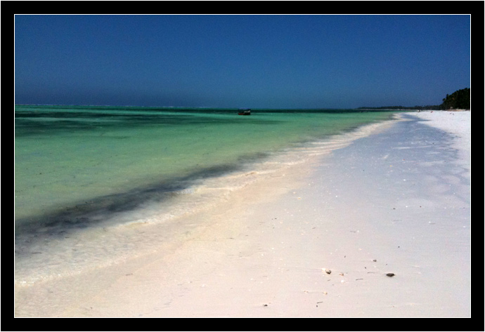
We spent a little more than a week on the island of Zanzibar, near a tiny village named Bwejuu.  We spent the majority of that time very near our lodge, but we did manage to get out of our hammocks long enough to do a 2-tank dive with the Rising Sun Dive Center.  Glad we did!  The diving staff that worked there were great and we saw or did something new on each of our dives!

Technical stuff:

In some ways, I wish we could reshoot elements of this video.  For instance, our underwater footage is overwhelming blue — so close to monochrome that my normal trick of color-correcting some red back into the imagery didn’t work at all.  In all fairness, I expected this would happen as soon as I learned we would be diving at a depth of almost 100 feet.  Water filters out the colors of light and red is the first to go.  Besides that, it was an overcast day, and the sunlight wasn’t that strong to begin with.  We could see just fine down there, but our point-and-shoot camera can only do so much…  (Too bad we can’t travel with diving lights, too!)

We also recorded our voice-overs outdoors, at the lodge.  The tropical scenery behind us is quite fitting, but the wind noise was something we couldn’t avoid.  Not to mention the birds.

Still, even with these minor problems, I think you’ll get a good sense of what our dives were like when you watch this video.

Notes

Rising Sun Dive Center
Breezes Beach Club and Spa
Our tour review of the Rising Sun Dive Center

(more…)

July 9, 2011

Zanzibar is Dangerous

The

Yesterday, as we walked down a lonely stretch of beach, Oksana and I were mugged by a heavily-muscled man with a machete.

Our day started out well enough. After breakfast, we decided to follow up on an email we’d received from a dive center at one of the resorts. We checked a map and realized it was a walkable distance down the beach. To be sure, the owners of the lodge we were staying at warned us about a certain stretch of empty property where thieves had been known to hang out, but they assured us it was only dangerous for people with bags or cameras.

Oksana tucked a few bills away in her swimsuit and I debated long and hard about the two things I wanted to bring: My iPhone and our GPS. The GPS because I wanted to record at least one good track duringour stay on the Eastern side of Zanzibar, the iPhone because we were going to pitch a work-trade deal with the dive center and can bring up our previous diving videos on it.

I also carried my Swiss Army knife. I wouldn’t risk a fight over the iPhone itself, but I would for the data that’s on it.
(more…)

April 8, 2011

Thoughts on Bolivia

I’m glad we approached Bolivia after traveling through Ecuador and Peru first.  I think it lessened the inevitable culture shock.  On the other hand, when we arrived in Chile (a post for another day), it felt almost like we were returning to the United States, the quality of living (and prices!) were so much higher.  Below are the things that occurred to me as we traveled through Bolivia.

Coca Leaves

What’s the first thing you think about when someone mentioned Bolivia.  It’s “cocaine,” isn’t it?  The whole time I was there, I didn’t see or hear anything about the white powder.  Not that I was running in those circles or anything, but no one even offered it to me.  I found it surprising, considering that it happened more than once in Peru.

What Bolivia does have, though, is coca leaves.  You can buy them by the bag-full at any outdoor market and, if you ask for the activator (a sticky, bitter substance made of ash, sap, bananas and/or who knows what else), you can get “high” with them in a perfectly legal, even morally acceptable way.

Oksana and I tried them a couple times and the effects, for me, were on par with drinking a venti-sized cup of coffee from Starbucks (assuming, of course, your coffee tastes like freshly-cut grass and completely numbs your cheek and tongue!)  Oksana really liked chewing coca leaves while hiking – they allowed her to completely ignore any pain she was feeling on the long, steep hike up Colca Canyon.

(In Potosí, it was almost comical the way the miners kept stuffing the leaves into their mouths.  Plucking each stem, they’d add them one at a time, over the course of hours, until their cheeks were bulging like a greedy hamster!)

After seeing the widespread use of coca leaves in both Peru and Bolivia, I’d guess it’s about as addictive as marijuana and about as socially acceptable as smoking cigarettes.  I wonder if that’s why the two countries have relatively few smokers…

(more…)